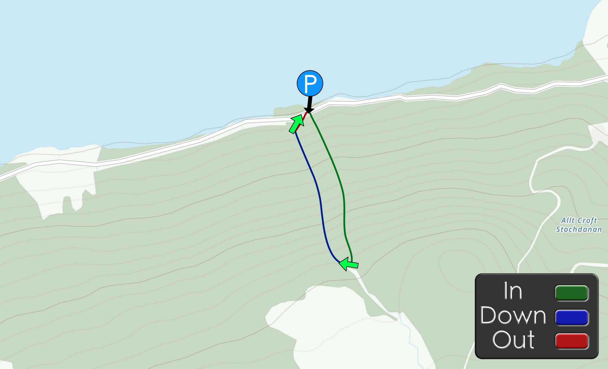
Approach by Car: Park in the large off road parking area at 56.710543, -3.890722 which is TR of the canyon.
Approach by foot: From the car, cross the road and walk up hill keeping the river to your right (TR). There is a rough track to follow which goes close to the river.
Canyon entry: The river will begin to level out at the 300m contour, Find a suitable spot to get in and start your decent.
Canyon descent: (Unknown)
Exit: Once you get to the bridge exit (TR)
Escapes: (Unknown)
First Decent: (Unknown)
If so we would love to hear from you in the comment section below! Let the whole community know more about this canyon, Information such as time taken to: approach, descend and exit are extremely helpful, as well as any new hazards you may have come across whilst canyoning at this location.
If any information on this page is missing, incorrect or out of date, please get in contact with us directly so we can rectify as soon as possible.
DisclaimerNo responsibility or liability is taken for any harm, death or loss of property from using the information found on Canyon Log. Topo features, descriptions and notes may not be accurate and could be misleading. You must carry anchor building materials, be experienced and use your own judgement when canyoning. Flooding can completely change the layout, features and conditions. Insufficient experience may result in death.
We use cookies to ensure that we give you the best experience on Canyon Log. If you continue to use this site we will assume that you are happy with it.


