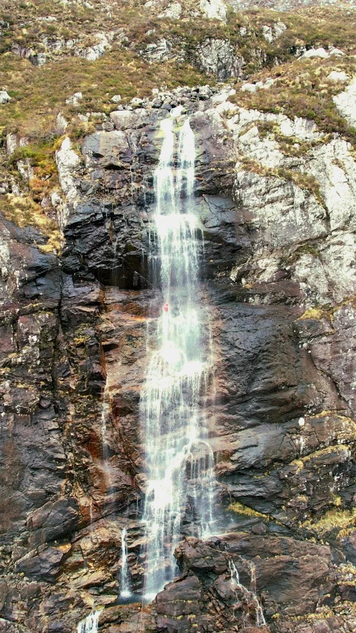
Difficult to access and very exposed. A bolting kit is recommended as anchors on the falls may be dangerous or completely destroyed. Water levels rise rapidly after rain although rigged TL of flow be aware as access can become difficult.
Description
Approach by Car: (Unknown)
Approach by foot: (Unknown)
Canyon entry: (Unknown)
Canyon descent: (Unknown)
Exit: (Unknown)
Escapes: (Unknown)
First Decent: (Unknown)
If so we would love to hear from you in the comment section below! Let the whole community know more about this canyon, Information such as time taken to: approach, descend and exit are extremely helpful, as well as any new hazards you may have come across whilst canyoning at this location.
If any information on this page is missing, incorrect or out of date, please get in contact with us directly so we can rectify as soon as possible.
DisclaimerNo responsibility or liability is taken for any harm, death or loss of property from using the information found on Canyon Log. Topo features, descriptions and notes may not be accurate and could be misleading. You must carry anchor building materials, be experienced and use your own judgement when canyoning. Flooding can completely change the layout, features and conditions. Insufficient experience may result in death.
A moderate walk-in. Old rusty double bolted anchor and newer triple bolted anchor on TL. Plenty of ghost anchors on TR. Done in medium flow. Solid smooth rock. Sections of overhangs, pools and decent slab.
TL is mostly dry abseil, TR is in the flow. It is possible to abseil only 140m and walk-off.
We use cookies to ensure that we give you the best experience on Canyon Log. If you continue to use this site we will assume that you are happy with it.


A moderate walk-in. Old rusty double bolted anchor and newer triple bolted anchor on TL. Plenty of ghost anchors on TR. Done in medium flow. Solid smooth rock. Sections of overhangs, pools and decent slab.
TL is mostly dry abseil, TR is in the flow. It is possible to abseil only 140m and walk-off.
Short & steep walk back up on TL.