Batchelor's Burn
Summary
This cold mountain burn features two exciting rappels interspersed with a long, mellow (but scenic) gorge walk through birch and pine forest.
Canyon Descent:
60m
Highest Drop:
15m
Canyon Length:
800m
Minimum Ropes:
1X 60m
Flood Risk:
Medium
Access Type:
Public
Rock Type:
Psammite / Granite
Catchment:
16km2
*No Water Level Indicator
*No Topo map available
Duration: in, down and out:
IN 15mins DOWN 1hr 30mins OUT 15mins
Anchors
Natural
Notes
May 2025 - currently no bolts in this canyon. Descended in low flow.
Be wary of rope drag on the first abseil - test pull advised as rope may snag in middle waterfall. River name: Leonach Burn
Second pitch also has a risk of rope friction - would work best as two pitches if bolts added in future.
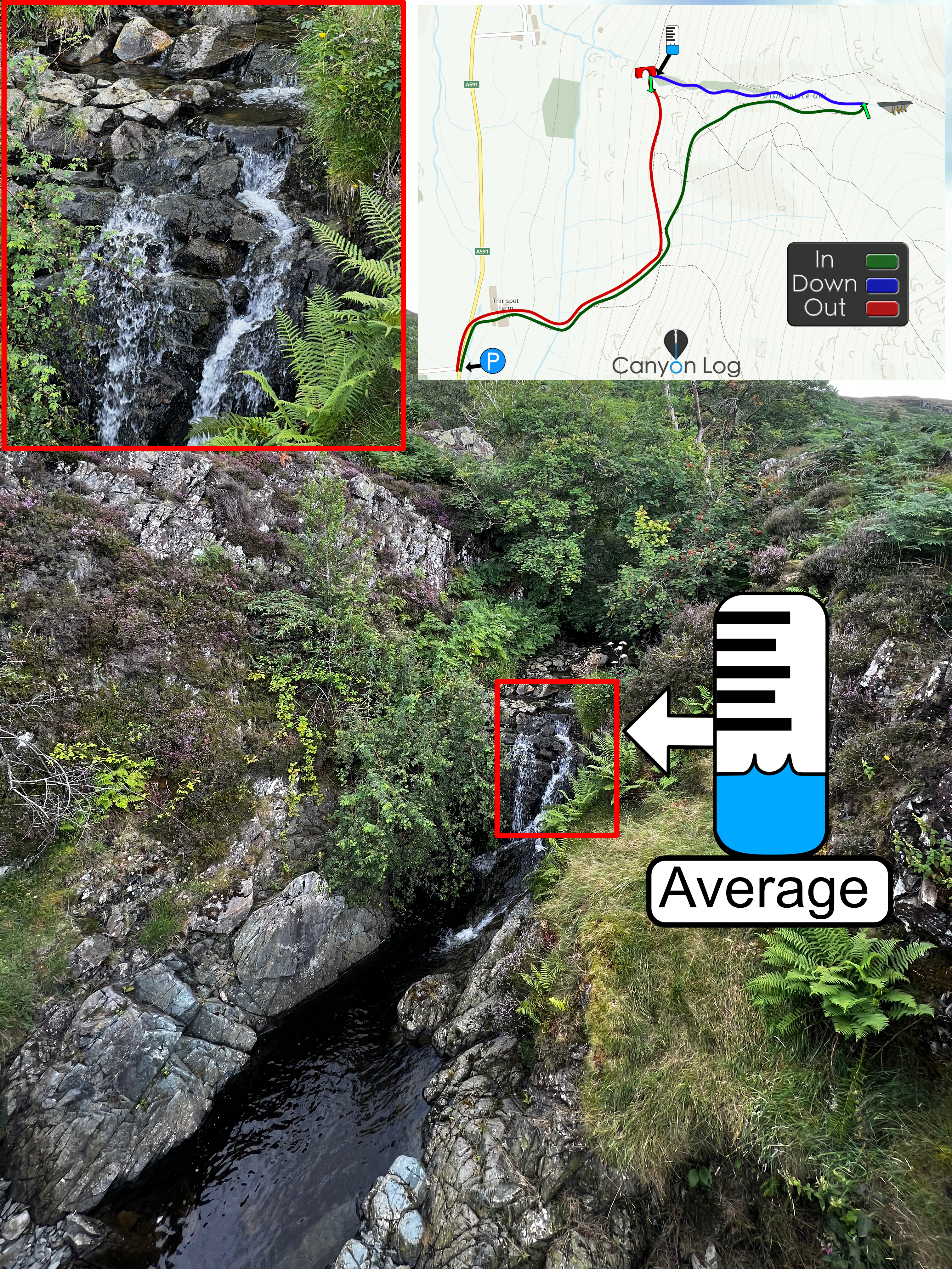
Description
Best approached from B9007 on the wind farm track. Turn right on a track just before the bridge (note black overflow pipes) and after 50m descend a gentle bank to two large pools. Get in here.
Downclimb over a series of small drops and pools (not jumpable) to a larger, shallow pool before the first abseil. This atmospheric 15m rappel into a deep pool is currently rigged using a chockstone thread 10m back from the edge (marked by in-situ old agricultural rope). The pool below is deep and has a variety of jumps varying from 1-10m in height on offer. Simple down climbing gives way to easy gorge walking through spaced pine trees for about 500m.
The final 30m rappel is less steep but comprises three interesting features. Natural anchors were established using trees TR. First descend a slippery chute into a 5m vertical waterfall and small pool below. The river turns abruptly left mid pitch to enter a second waterfall into an undercut groove, which features an interesting cave. This requires bridging to avoid the flow and would pose a significant hazard in higher flows. Page information - James Nicholson
First Recorded Descent Team
Jamie Walker - 2007
Page Information
James Nicholson, Joe Barlow
.


Have You Descended This Canyon Recently?
If so we would love to hear from you in the comment section below! Let the whole community know more about this canyon, Information such as time taken to: approach, descend and exit are extremely helpful, as well as any new hazards you may have come across whilst canyoning at this location.
If any information on this page is missing, incorrect or out of date, please get in contact with us directly so we can rectify as soon as possible.
Disclaimer
No responsibility or liability is taken for any harm, death or loss of property from using the information found on Canyon Log. Topo features, descriptions and notes may not be accurate and could be misleading. You must carry anchor building materials, be experienced and use your own judgement when canyoning. Flooding can completely change the layout, features and conditions. Insufficient experience may result in death.

Descended on the 3/10/25 team of 2 in low flow.
River canyon, very cool. Looks like it could get very pushy in there with higher flow.
Couldn’t find anchors on the the first pitch but these are unnecessary with a jump that good.
Second pitch is cork screw shaped could make rope retrieval difficult, there are plenty of natural anchors to ghost from if you climb up above the falls true right this also created a clean line to retrieve ropes