Attadale
Summary
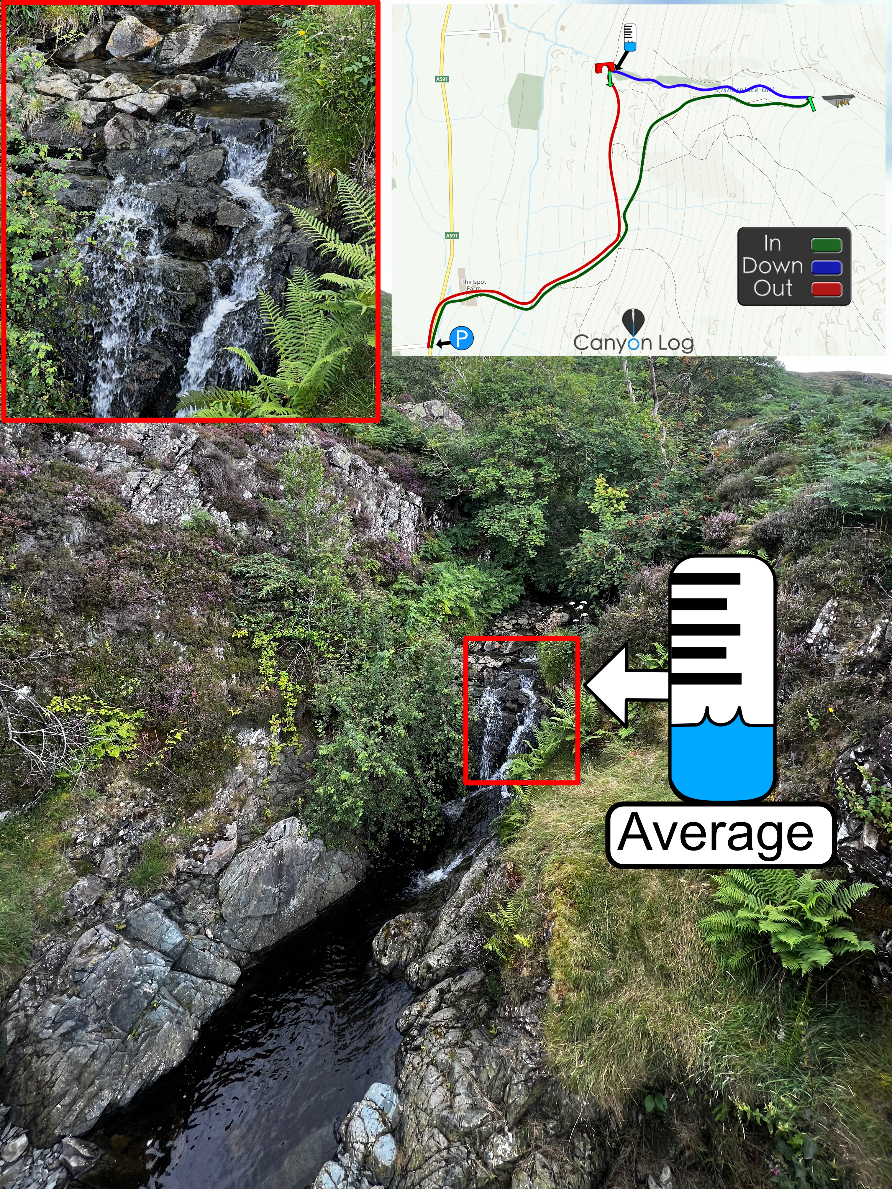
~4 pitches. Low water canyon, has a relatively new hydro with extraction
somewhere. Relatively escapable throughout with small sections of encasement. As seen in
Find Mòr film.
Canyon Descent:
135m
Highest Drop:
20m
Canyon Length:
880m
Minimum Ropes:
Flood Risk:
Low
Access Type:
Public
Rock Type:
Psammite
Catchment:
4.16km2
*No Water Level Indicator
*No Topo map available
Duration: in, down and out:
IN: DOWN: 1-2hrs OUT:
Anchors
Mixed
Notes
(Allt a Ghiubhais)
Description
Parking: Not sure if it’s allowed, check yourself. If not, there’s a large layby on the
main road south just up the hill.
Check levels: Can check at the bottom of the canyon.
Safe levels: Low flow canyon, not sure of the hydro above
Duration: 1-2 hours
Approach: Follow trail from car park to canyon, crossing the river at the hydro building.
Follow trail up river left.
Get-in: Enter when it starts to flatten out.
Exit: Follow to the bottom, regular escapes possible
First Recorded Descent Team
Team - Dale Strang, Charlotte Workman, Steve Small, Kirsten Cronie, Jack Robertshaw,
Grant Bowden. Sept 2024
.


Have You Descended This Canyon Recently?
If so we would love to hear from you in the comment section below! Let the whole community know more about this canyon, Information such as time taken to: approach, descend and exit are extremely helpful, as well as any new hazards you may have come across whilst canyoning at this location.
If any information on this page is missing, incorrect or out of date, please get in contact with us directly so we can rectify as soon as possible.
Disclaimer
No responsibility or liability is taken for any harm, death or loss of property from using the information found on Canyon Log. Topo features, descriptions and notes may not be accurate and could be misleading. You must carry anchor building materials, be experienced and use your own judgement when canyoning. Flooding can completely change the layout, features and conditions. Insufficient experience may result in death.
